The Sahara is the biggest hot desert in the world! It is in Africa. You would see giant sand dunes and rocky hills there. 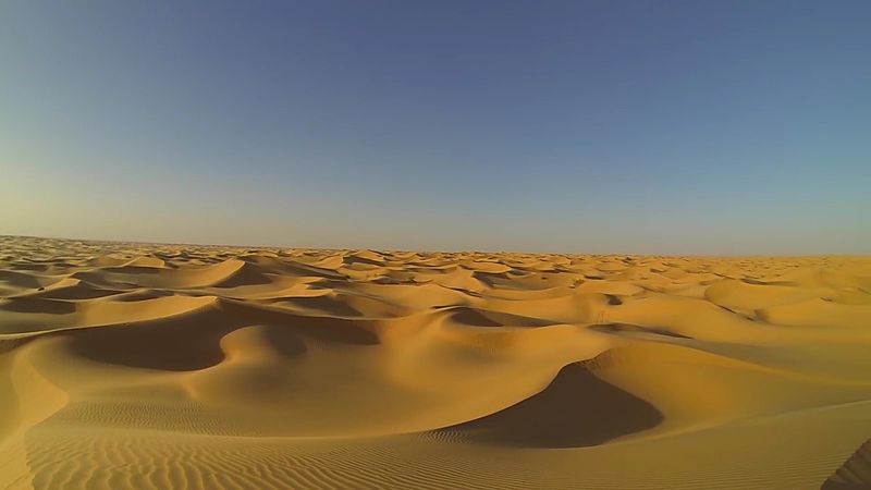

The Sahara is a massive desert in North Africa. It is so big that it covers almost one-third of the whole continent! Most of the time, it is very hot and dry because it almost never rains. You might see "ergs," which are huge seas of sand, or "oases," which are green spots with water and palm trees. 

The Sahara is the world’s largest hot desert, stretching across North Africa from the Red Sea to the Atlantic Ocean. It covers parts of many countries, including Algeria, Egypt, and Mali. The landscape is very diverse. It has "ergs" (large sand dunes), "hamada" (rocky plateaus), and "wadis" (dry valleys that only fill with water when it rains).
The climate is extremely harsh. It is located under a high-pressure belt that prevents clouds from forming, leading to over 3,600 hours of sunshine a year. In some places, the ground can reach temperatures of 80°C (176°F)! 
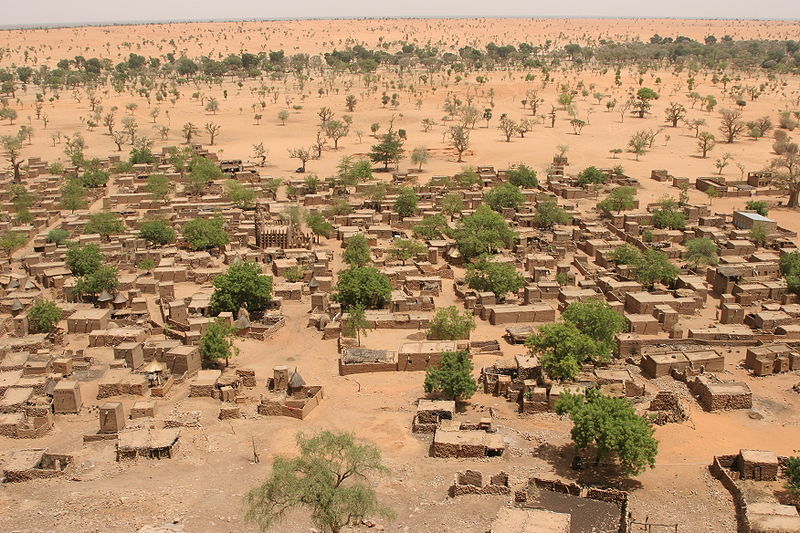
Life in the Sahara is tough but interesting. Animals like the fennec fox and the addax antelope have adapted to live without much water. Humans also live here, often near oases where underground water reaches the surface. 

The Sahara is the largest hot desert on Earth, covering 9.2 million square kilometers—about 31% of the African continent. It spans from the Atlantic Ocean in the west to the Red Sea in the east. To the north, it is bordered by the Mediterranean Sea and the Atlas Mountains, while to the south it transitions into the Sahel, a belt of semi-arid savanna. 
The desert's geography is much more than just sand. While it contains massive sand seas called ergs, it also features rocky plateaus (hamada), gravel plains (reg), and salt flats. Several mountain ranges rise from the desert floor, including the Tibesti Mountains, where the highest peak, Emi Koussi, is located.
Historically, the Sahara has not always been a wasteland. Every 20,000 years, the Earth’s axis shifts, changing the location of the North African monsoon. This cycle has turned the Sahara into a green savanna many times in the past. Archaeological sites like Gobero in Niger show that ancient people, such as the Kiffians and Tenerians, lived on the shores of lakes that no longer exist. 
Today, the Sahara is home to various ethnic groups, including the Tuareg, who are famous for controlling trans-Saharan trade routes for centuries. 

The Sahara is the world's largest hot desert and the third-largest desert overall, surpassed only by the polar deserts of Antarctica and the Arctic. Spanning approximately 9.2 million square kilometers, it encompasses nearly a third of the African continent. Its boundaries are defined by the Atlantic Ocean to the west, the Atlas Mountains and Mediterranean Sea to the north, the Red Sea to the east, and the Sahelian steppe to the south. The Sahara is a physiographic province of immense diversity, featuring ergs (sand seas), hamadas (rocky plateaus), wadis (seasonal valleys), and volcanic massifs such as the Ahaggar and Tibesti ranges. 
The hyper-aridity of the central Sahara is driven by the subtropical ridge, a belt of high pressure that suppresses cloud formation and convection. This creates a stable atmosphere where rainfall is virtually non-existent, particularly in the eastern Libyan Desert, which rivals the Atacama as the driest place on Earth. Temperatures are equally extreme; ground temperatures have been recorded as high as 80°C (176°F) in parts of Chad. However, the Sahara’s climate is not static. The 'Orbital Monsoon Hypothesis' explains that a 20,000-year cycle caused by the precession of Earth's axis periodically strengthens the North African monsoon, transforming the desert into a 'Green Sahara' covered in savanna and lakes. 
Archaeological evidence confirms that humans thrived during these humid periods. At the Gobero site in Niger, researchers discovered the remains of two distinct Stone Age cultures: the tall, robust Kiffians (10,000–8,000 years ago) and the shorter Tenerians (starting around 4600 BCE). Furthermore, the Tashwinat Mummy found at Uan Muhuggiag in Libya dates back 5,600 years, making it older than the earliest known Egyptian mummies. These populations left behind a vast record of petroglyphs depicting riverine animals, suggesting a vibrant ecosystem that supported crocodiles, giraffes, and cattle.
In antiquity, the Garamantes civilization (c. 500 BCE) flourished in modern-day Libya by developing sophisticated 'foggara' irrigation systems to tap into fossil water aquifers. Later, the desert became a hub for trans-Saharan trade, facilitated by the introduction of the dromedary camel. Phoenicians, Greeks, and Romans all interacted with the desert's fringes, but it was the Islamic and Arabic expansions starting in the 7th century that most profoundly shaped the region's modern linguistic and cultural landscape. 
During the 19th and 20th centuries, the Sahara was largely partitioned by European colonial powers, particularly France, which controlled a vast empire stretching from Algeria to Senegal. 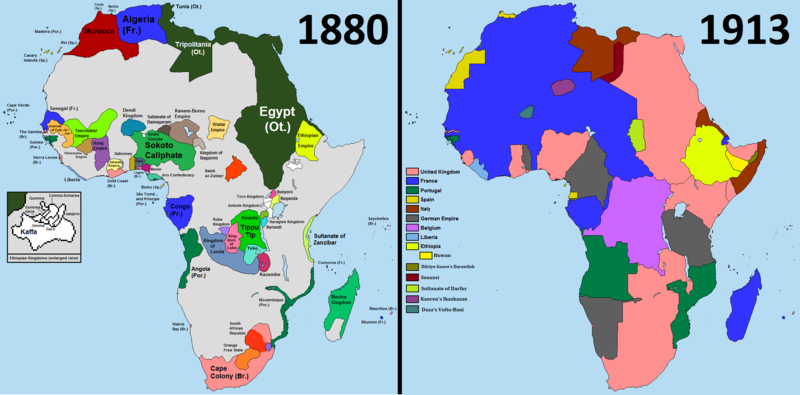

The Sahara's human population is a mosaic of ethnic groups, including the Amazigh (Berber), Tuareg, Sahrawis, and Toubou. While Arabic is the most widely spoken language, Berber dialects and Tifinagh script remain central to the identity of groups like the Tuareg. 
🖼️ Images & Media (24)

+ 12 more
✨ What else?
Related topics you might enjoy
🔬 Go deeper
More advanced topics to explore
🪜 Step back
Simpler topics to build understanding